Some vegetation changes occur on a landscape scale, such as an expanding plant community (e.g., advancing pinyon/juniper or invasive weeds) or as cumulative effects (e.g., increased acreage of dominance by annuals). Monitoring these changes helps to identify transitions across thresholds, from one state to another. (See information on state and transition models in Appendix B – Ecological Sites.) Although such changes can be detected or tracked with many individual plots, it is often more efficient to track landscape patterns with photos, or other remotely sensed imagery, or maps. While some landscape-scale issues or changes are easy to observe, others can be detected through the use of pattern analysis techniques. Suitable data are needed for these analyses. It is imperative to include location markers for georeferencing. Appendix F — Scales in Monitoring further discusses this topic.
Photos or Other Remote Sensing
Vegetation changes visible at the landscape scale can be tracked with remote sensing when images are interpreted correctly. GIS software can be used in concert with remotely sensed data to capture, analyze and produce raster data sets that contain metrics of change across landscapes. Stereo coverage is desirable (Appendix G – Remotes Sensing to Monitor Rangelands).
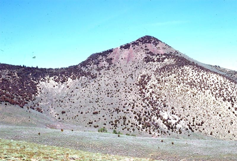 Figure 35. This photo pair taken by Robin Tausch in 1971 and 2007 in the Shoshone Range
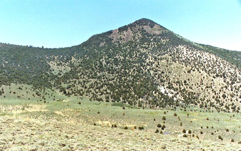 has helped many people understand the consequences of altered fire regimes and pinyon-Juniper encroachment.
Weed Maps
Maps of weed inventories can show patterns of dispersal. They help identify vectors and track the long-term control or expansion of individual populations. Maps can also be used with sampling to document weed density or weed control treatments. The value of these maps depends on the accuracy and completeness of the weed inventory data. Weed maps (point locations or patch polygons), maps of disturbance, and remote sensing can help stratify the landscape and prioritize areas for coordinated weed surveillance and mapping. Because weed management and monitoring are so important, continued development of monitoring protocols are expected and needed. One critical activity is consistently recording into a permanent and readily accessible database the structured and random observations of agency personnel, ranchers, cooperative weed management group employees or volunteers, the public, and other land users. To accomplish this, the Nevada Department of Agriculture encourages all users to enter observations of noxious and invasive weeds into a smart phone application named EDDMaps (https://www.eddmaps.org/ ). The EDDMaps application has an integrated photo library.
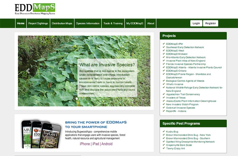 Figure 34. The EDDMapS App. Supported by Nevada Department of Agriculture has been used across Nevada to map weed distributions.
Swanson, S., Schultz, B., Novak-Echenique, P., Dyer, K., McCuin, G., Linebaugh, J., Perryman, P., Tueller, P., Jenkins, R., Scherrer, B., Vogel, T., Voth, D., Freese, M., Shane, R., McGowan, K.
2018,
Nevada Rangeland Monitoring Handbook (3rd) | Chapter 09 - Detecting Patterns of Vegetation Change Across a Landscape,
Extension | University of Nevada, Reno, SP-18-03
