Crucial Elements of a Joint Cooperative Monitoring Program
- Coordination requires frequent communication between the permittee and the agency rangeland manager. A valuable benefit of honest and frequent communication is that both parties gain an understanding of each other’s values, needs, abilities, etc., and will most likely develop a better working relationship over time. Frequent coordination and communication is the key to avoiding misunderstanding, and ensuring both parties know what monitoring is being done and why. The results of monitoring that is developed by both parties will be more acceptable and defensible if there are challenges, and on-the-ground improvement will more likely be achieved.
- The cooperative monitoring program should be voluntary, and both parties must desire success and achievement of stewardship objectives.
- Both parties need to confirm their sincere interest in securing the long-term health of the resources. This is often assumed as a given. However, it is important that both parties hear each other affirm this goal. This could be the first point of agreement, but if both parties cannot both agree on this point, there is no need to proceed further in a joint monitoring program.
- Make the effort to get support of the administrative hierarchy in the agency and the ranch operation (and other operators on the allotment, if you are operating on a shared common allotment). At a minimum, those people responsible for livestock’s movement on the rangelands, private and public, need to be on board and participating from the onset.
Stepwise Procedure for Establishing and Continuing a Joint Cooperative Monitoring Program
Permittee participation in cooperative monitoring is often voluntary. It can be tailored to the specific permittee’s issues, background and available resources. Ideally, permittees and agencies will make cooperative monitoring a high priority. To the extent that a permittee is interested in participating in cooperative monitoring, but feels that the following is more than he/she is interested in, cooperative monitoring can be developed to address specific issues or the complete picture at a level that is feasible and comfortable.
- To Begin — The permittee and agency range specialist might discuss what each hopes to accomplish through cooperative monitoring, why they want to participate in cooperative monitoring, and the issues or concerns they would like to address. They might also identify the level of commitment each can make to cooperative monitoring and the importance of this allotment to the permittee’s and agency’s operation. They might discuss how the subsequent monitoring data are going to be used and how responsive either can be to making different kinds of changes. For example, adding several troughs to an existing pipeline can be done in about one year, but significant changes in livestock numbers will take at least three years, especially increases. What is most important is that they get started. Most of the issues will become apparent as cooperative monitoring unfolds. Make copies — Copy all pertinent allotment information from the agency official allotment file. Make copies of the agency management and monitoring plan for permittee’s allotments. The livestock operator should have a copy of this information to understand the history and future direction for management of the allotment. Review Management and Monitoring Plans — The permittee and agency range staff should review the allotment management and monitoring plans as an initial starting point. If no plans are available, it may be very beneficial to develop both of these plans in conjunction with establishing a cooperative monitoring plan. During the review process, discuss any points of concern, i.e., incorrect information, missing data, permit administration, etc. The Monitoring Plan Form 1 and Monitoring Area Form 2 in Appendix K or the Cooperative Monitoring Agreement Template (page 55) can be useful in organizing your thoughts and assuring that all necessary topics have been covered during this process, as well as in the field. Tour the Allotment — The second meeting will take at least three years, especially increases. What is most important is that they get started. Most of the issues will become apparent as cooperative monitoring unfolds.
- Copy all pertinent allotment information from the agency official allotment file. Make copies of the agency management and monitoring plan for permittee’s allotments. The livestock operator should have a copy of this information to understand the history and future direction for management of the allotment.
- Review Management and Monitoring Plans — The permittee and agency range staff should review the allotment management and monitoring plans as an initial starting point. If no plans are available, it may be very beneficial to develop both of these plans in conjunction with establishing a cooperative monitoring plan. During the review process, discuss any points of concern, i.e., incorrect information, missing data, permit administration, etc. The Monitoring Plan Form 1 and Monitoring Area Form 2 in Appendix K or the Cooperative Monitoring Agreement Template (page 55) can be useful in organizing your thoughts and assuring that all necessary topics have been covered during this process, as well as in the field.
- Tour the Allotment — The second meeting should be in the field at the monitoring site(s). The tour should be constructive and not confrontational. The purpose is to help everyone fully understand the resource, associated concerns and important operational issues, i.e., livestock movement, infrastructure requirements, livestock water locations, wildlife habitat needs, fire or potential fire impacts, etc. Be sure to have a copy of the completed Monitoring Plan form or Cooperative Monitoring Agreement Template and the Ranchers’ Monitoring Guide (Perryman et al. 2006), with blank forms on hand for reference during the tour. On this tour:
Seek Assistance When Needed
Do not be afraid to ask for help. State office personnel of the federal land management agencies are aware and supportive of the joint cooperative monitoring program and can provide assistance. These individuals can help you and the district office clarify the agency policy regarding joint cooperative monitoring; and advise you on how to set up and get a monitoring program started. Your local Extension educator will also be willing to assist you in this endeavor and can get assistance from Cooperative Extension state specialists or other faculty at the University. The Nevada Department of Agriculture can also assist in initiating a cooperative monitoring program and plan. If you prefer to obtain the assistance of private range consultants, they can also assist you.
By the Numbers
- Identify the objective(s) for the allotment.
- Identify the key area(s) or designated monitoring area(s).
- Clarify the resource objectives.
- Affirm, modify or develop your allotment monitoring plan.
-
- Identify the Objective/s for the Allotment — This is an extremely important and critical step. (See, Resource Objectives, Pages 2-6, especially pages 5-6 and Appendix E – Characteristics of Good Objectives.) Objectives identify data requirements, and determine what monitoring methods are required and how often measurements need to be taken. This will ultimately guide livestock movement. Objectives and monitoring methods must be developed that can be measured, accomplished, and agreed upon by all principal parties. Do not skimp on this task. If objectives have been set, discuss why they were selected and if they are correct. Remember resource objectives are SMART. See Pages 5-6.
- Identify the Key Area(s) or Designated Monitoring Area(s) – Key areas should be selected and agreed to jointly. (See Appendix H — Procedures for Selecting Key Areas and Key Species.) If key areas have already been selected, they need to be reconfirmed jointly as correct and at an appropriate site for the objective that is representative of pertinent areas in the allotment. If a site is not reconfirmed as the appropriate monitoring site, consideration must be given to the historical data associated with the site, and a determination should be made whether or not to continue monitoring this site to retain trend information. A designated monitoring area (DMA) or critical area may be jointly chosen that is not a key area. (See Appendix H – Procedures for Selecting Key Areas and Key Species). The designated monitoring area will focus on an important and specific issue unique to that particular riparian area. It will usually not be representative of management of the whole allotment and will only represent a site specific issue. If a designated monitoring area is chosen, a key area representative of the remainder of the allotment must also be chosen.
- Clarify the Resource Objectives — Describe how objectives will look at each study site. Identify key species (Appendix H – Procedures for Selecting Key Areas and Key Species) and describe how they will change and vary through time if management is successful. Often, an increase or decrease in one or more key species will be an objective. However, this cannot go on forever and eventually species composition will change in new directions because of plant succession, fire, etc. Check to be sure that objectives for each study area are meaningful, realistic and related to management.
- Affirm, Modify, or Develop Your Allotment Monitoring Plan as Necessary — Do not be afraid to request help from other specialists, both from within the agency or from other agencies, and University faculty. Take the time and make the effort to establish a plan and set monitoring protocols that you can perform that provide the data required to track livestock or other managements’ impacts, positive or negative, over time. Make sure that the monitoring plan is achievable and not unnecessarily complicated or time consuming. If you are not confident in your ability to carry out the monitoring program, get help.
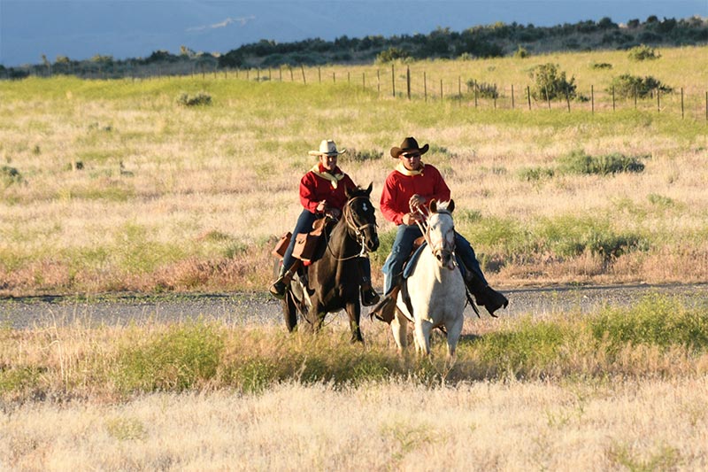 Figure 44. In much of Nevada, there is no better way to see management issues, opportunities and results than from the back of a horse. Photo courtesy BLM.
- Follow Through – See the Ranchers’ Monitoring Guide (Perryman et al. 2006). Once a cooperative monitoring plan is developed, everyone must be diligent in carrying out their respective roles. Whenever possible, both agency and permittee should collect short- and long-term data together. When together, collecting data is a great time to ask questions, discuss management ideas, and develop a common understanding for collaboration given the realities of response potentials, timelines, workloads, budgets and outside funding. This does not mean that both parties must be together every time that monitoring data are collected, but advance communication of when data will be collected must be shared and the option to attend left open. The Ranchers’ Monitoring Guide (Perryman et al. 2006) provides a selection of monitoring methods that are agency approved, generally easy to use, require a limited amount of time, and tend to produce consistently reliable results. Not all methods in the Ranchers’ Monitoring Guide should be used at a monitoring site. The method or methods selected will depend upon the resource objective, ability and time of the data collector, etc. Keep it simple, effective and correct to assure the best data possible. With the enthusiasm to start a new project, do not commit to more monitoring than needed nor more than both parties will make time for in their busy schedules.
- Interpretation and Use of Data — Once data are collected, copies of the data must be shared and maintained by all parties of a cooperative monitoring agreement. In order to be of use, the data must also be analyzed to determine what, if any, effects management had upon the objectives; if the objective(s), triggers, and/or indicators are correct; if the monitoring sites are correct; or if management or monitoring should be modified. Once the analysis and interpretation is made, then a determination of action for the subsequent grazing season must be made. Analysis and interpretation must be done collaboratively among the permittee(s) and agency rangeland manager(s), at a minimum. A collaborative and adaptive management approach provides the best format and process for this type of management to succeed.
Cooperative Monitoring Agreement Template
This Template is based on the Nevada Rangeland Monitoring Handbook, including Appendix A - Cooperative Monitoring and the Ranchers’ Monitoring Guide (Perryman et al. 2017) which encourages the use of the Nevada Department of Agriculture rangeland monitoring application.
Download the Cooperative Monitoring Agreement Template (fillable PDF)
Memorandum of Understanding between the Public Lands Council and Forest Service
This MEMORANDUM OF UNDERS TANDJNG (MOU) is hereby made and entered into by and between the Public Lands Council, hereinafter referred to as " PLC," and the USD A, Forest Service, Washington Office, hereinafter referred to as the " U.S. Forest Service."
Title: Service-wide Memorandum of Understanding on the Cooperative Monitoring Program
- PURPOSE: The purpose of this MOU is to document the cooperation between the parties to encourage, promote, and increase allotment level monitoring on National Forest System (NFS) lands. With this MOU the PLC members that are recognized as livestock grazing permittees on NFS lands would assist to develop and implement a cooperative monitoring program for their assigned livestock grazing allotment(s) on national forests and national grass lands, in accordance with the following provisions.
- STATEMENT OF MUTUAL BENEFIT AND INTERESTS:
Both the PLC and the U.S. FOREST SERVICE have responsibilities and interests in rangelands management. Monitoring of rangelands is essential to the sustainability of livestock grazing activities on national forests and grasslands. However, cooperative monitoring enhances the working relationship of the parties at the local level when the parties cooperatively acquire, analyze, and approve data collections to assist with creating rangeland management programs that enhance and improve the condition of rangelands. Furthermore, cooperative monitoring would also reduce impacts associated with livestock grazing activities
The U.S. Forest Service is a natural resource agency dedicated to sustained management of the nation's natural resources with service to people, through its laws and regulations set forth by the Secretary of Agriculture. The U.S. Forest Service strives to restore, maintain, and enhance the condition of rangelands with livestock grazing activities that would sustain, protect, and improve the type and amount of forage plant species. Their opportunity to initiate, pro mote, and implement cooperative monitoring programs with consenting livestock grazing permittees would contribute immensely towards effectively addressing and resolving range land management issues associated with livestock grazing activities through cooperative relationships with PLC membership. At the present time, livestock grazing activities are permitted on NFS lands in approximately 30 states for a variety of permit holders. These are single individuals to several types of legal entities.
In consideration of the above premises, the parties agree as follows:
- THE PUBLIC LANDS COUNCIL SHALL:
- Publicize and support the cooperative rangeland monitoring progran1among its membership, particularly those authorized to graze livestock on national forests and/or national grasslands.
- Serve as a liaison to address issues of concern for lives toc k grazing permittees that arise during the administration of this MOU.
- Prior to the annual PLC meeting, discuss and provide an update to the U.S. Forest Service for any cooperative activities by their membership that are also recognized as livestock grazing permittees on NFS lands and who voluntarily decided to participate in the cooperative rangeland monitoring program.
- At the annual PLC meeting, provide an Agenda item to discuss any cooperative monitoring activities that are in progress for their members hip with Forest Service livestock grazing allotments.
- THE U.S. FOREST SERVICE SHALL:
- Identify grazing allotments where cooperative monitoring data is currently collected and analyzed with consenting livestock grazing permittees for their assigned allotment(s) on national forests and grasslands.
- Contact livestock grazing permittees and invite them to participate in the cooperative monitoring program and establish a cooperative rangeland monitoring program for their assigned grazing allotment(s).
- Encourage, and increase grazing allotments participating in the monitoring program each year, to the maximum extent feasible with available resources.
- Prior to the annual PLC meeting, discuss and provide an update to the PLC for any cooperative monitoring activities in place with livestock grazing permittees that are also recognize d as PLC members and who voluntarily decided to participate in the cooperative rangeland monitoring program.
- At the annual PLC meeting. participate in the Agenda item discuss ion that addresses cooperative monitoring activities on National Forest System lands.
- Work cooperatively with livestock grazing permittees participating in the cooperative monitoring program to develop allotment monitoring plans for their assigned grazing allotment(s). APPENDIX A displays information that was developed to address the cooperative range land monitoring program and allotment monitoring plan that would be developed between local Forest Officers and PLC members for their assigned livestock grazing allotment(s).
- Provide information and updates of rangelands condition changes as it becomes available to the livestock grazing permittees for their assigned livestock grazing allotment(s).
- Work with other Federal agencies to improve consistency of range lands management associated with monitoring protocols. data standards, and data management.
- Reserve the management flexibility to establish priorities that would continue cooperative monitoring activities with livestock grazing permittees.
- As needed, coordinate with US DA-Natura l Resources Conservation Service staff to inquire and provide soil surveys and/or vegetation correlation information for sites involved in cooperative monitoring.
- Ensure conformance with U.S. Forest Service protocols. The planning. collection and interpretation of monitoring data will be jointly conducted by livestock grazing permittees and local Forest Officers pursuant to the agency's protocols developed to measure forage use and/or indicators of range land condition. The Forest Officers may check data collected and presented by the permittee or permittee's representative prior to adopting it. The Forest Officers shall adopt data that meets its Agency standards. In the absence of monitoring by the livestock grazing permittee or a permittee's representative. the Forest Officers will monitor independently using established protocols. The local Forest Officers will decide ho w to use or interpret monitoring data when there are differences between the data collection entities.
- Ensure agreement between the lives toc k grazing permittees and Forest Officers on methods for collect in g cooperative monitoring data, which must occur prior to implementing the allotment monitoring plan. The methods to be considered will be based on approved U.S. Forest Service protocols. When differences occur between the data collection entities in the methods to be used, the local Forest Officers will make the decision.
- Ensure that livestock grazing permittees have the option to see k assistance from other individuals or institutions such as the Cooperative Extension Service and/or consultants for monitoring data collection. Ensure the permittee(s) designate one individual to work with the local Forest Officers. As needed, Forest Officers or Cooperative Extension Service, operating under Interagency Agreements with the U.S. Forest Service, will provide training to the permittees or their representatives for agency approved methods.
- Ensure this MOU only addresses the interaction between the U.S. Forest Service and PLC. which represents its membership that is also recognize d as livestock grazing permittees on National Forest System lands. Further assure, this MOU in no way precludes the involvement of other federal land users or interested publics from participating in the cooperative rangeland monitoring program.
- IT IS MUTUALLY UNDERSTOOD AND AGREED BY AND BET WEEN THE PARTIES THAT:
In accordance with Federal law and U.S. Department of Agriculture policy, this institution is prohibited from discriminating0 11 the basis of race, color, national origin, sex, age, or disability. (Not all prohibited bases apply to all programs.)
To file a complaint of discrimination, write USDA, Director, Office of Civil Rights, Room 326-W, Whitten Building, 1400 Independence Avenue, SW, Washington, DC 20250-9410 or call (202) 720-5964 (voice and TDD). USDA is an equal opportunity provider and employer.
If the material is too small to permit the full statement to be included, the material must, at minimum, include the following statement, in print size no smaller than the text:
"This institution is an equal opportunity provider."
- PRINCIPAL CONTACTS Individuals listed below are authorized to act in their respective areas for matters related to this agreement.
Principal Cooperator Contacts:
| Cooperator Program Contact |
Cooperator Administrative Contact |
Name: Dustin Van Liew
Address: 1301 Pennsylvania Avenue, NW
City, State, Zip: Washington, DC 20004
Telephone: 202-347-0228
FAX: 202-638 -0607
Email: dvanliew@beef.org |
Name: Marci Schlup
Address: 130 1 Pennsylvania Avenue, NW
City, State, Zip: Washington, DC 20004
Telephone: 202-347-0228
FAX: 202-638-0607
Email: mschlup@beef.org |
| USFS Program Manager Contact |
USFS Administrative Contact |
Name: Annette Joseph
Address: USDA Forest Service
1400 Independence Ave. SW
Range Mgmt. Mailstop 1153
City, State, Zip: Washington DC 20250
Telephone: 202-205-0982
FAX: 703-235-0428
Email: altoniamathews@fs.fed.us |
Name: Altonia Mathews
Address: USDA Forest Service
1400 Independence Ave. SW
Range Mgmt. Mailstop 1153
City, State, Zip: Washington DC 20250
Telephone: 202-205-0982
FAX: 703-235-0428
Email: altoniamathews@fs.fed.us |
- ASSURANCE REGARDING FELONY CONVICT IO N OR TAX DELINQUENT STATUS FOR CORPORATE ENTITIES. This agreement is subject to the provisions contained in the Department of Interior, Environment, and Related Agencies Appropriations Act, 2012, P.L. No. 112-74, Division E, Section 433 and 434 regarding corporate felony convictions and corporate federal tax delinquencies. Accordingly, by entering into this agreement the cooperator acknowledges that it: I) does not have a tax delinquency, meaning that it is not subject to any unpaid Federal tax liability that has been assessed, for which all judicial and administrative remedies have been exhausted or have lapsed. and that is not being paid in a timely manner pursuant to an agreement with the authority responsible for collecting the tax liability, and (2) has not been convicted (or had an officer or agent acting on its behalf convicted) of a felon y criminal violation under any Federal law within 24 months preceding the agreement, unless a s us pending and de barring official of the United States Department of Agriculture has considered suspension or debarment is not necessary to protect the interests of the Government. lf cooperator fails to comply with these provisions, the U.S. Forest Service will annul this agreement and may recover any funds cooperator has expended in violation of sections 433 and 434.
- NOTICES. Any communications affecting the operations covered by this agreement give n by the U.S. Forest Service or the PLC is sufficient only if in writing and de live red in person, mailed, or transmitted electronically by e-mail or fax, as follows:
- To the U.S. Forest Service Pro g ram Manage r, at the address specified in the MOU.
- To the PLC, at the PLC ' s address shown in the MOU or such other address designated within the MOU.
Notices are effective when delivered in accordance with this provision, or on the effective date of the notice, whichever is later.
- PARTICIPATION IN SIMILAR ACTIVITIES. This MOU in no way restricts the U.S. Forest Service or the PLC from participating in similar activities with other public or private agencies, organizations, and individuals. Further, nothing in this MOU requires the U.S. Forest Service or Public Lands Council to notify or include interested public when cooperative monitoring is initiated by the livestock grazing permittee.
- ENDORSEMENT. Any of the PLC ' s contributions made under this MO U do not by direct reference or implication convey U.S. Forest Service endorsement of cooperator's products or activities, and does not by direct reference or implication convey the cooperator' s endorsement of the FS products or activities.
-
NONBINDING AGREEMENT. This MOU creates no right, benefit, or trust responsibility, substantive or procedural, enforceable by law or equity. The parties shall manage their respective resources and activities in a separate, coordinated and mutually beneficial manner to meet the purpose(s) of this MOU. Nothing in this MOU authorizes any of the parties to obligate or transfer anything of value.
Specific, prospective projects or activities that involve the transfer of funds, services, property, and/or anything of value to a party requires the execution of separate agreements and are contingent upon numerous factors, including, as applicable, but not limited to: agency availability of appropriated funds and other resources; cooperator availability of funds and other resources; agency and cooperator administrative and legal requirements (including agency authorization by statute); etc. This MOU neither provides, nor meets these criteria. If the parties elect to enter in to an obligation agreement that involves the transfer of funds, services, property, and/o r anything of value to a part y, then the applicable criteria must be met. Additionally, under a prospective agreement, each party operates under its own laws, regulations, and/or policies, and any Forest Service obligation is subject to the availability of appropriated funds and other resources. The negotiation, execution, and administration of these prospective agreements must comply with all applicable laws
Nothing in this MOU is intended to alter, limit, or expand the agencies’ statutory and regulatory authority.
- USE OF U.S. FOREST SERVICE INSIGNIA. In order for the PLC to use the U.S. Forest Service insignia on any published media, such as a Web page, printed publication, or audio visual production, permission must be granted from the U.S. Forest Service's Office of Communications. A written request must be submitted and approval gran ted in writing by the Office of Communications (Washington Office) prior to use of the insignia.
- MEMBERS OF U.S. CONGRESS. Pursuant to 41 U.S.C. 22, no U.S. member of, or U.S. delegate to, Congress shall be admitted to any share or part of this agreement, or benefits that may arise there from, either directly or indirectly.
- FREEDOM OF INFORMAT ION ACT (FOIA). Public access to MOU or agreement records must not be limited, except when such records must be kept confidential and would have been exempted from disclosure pursuant to Freedom of Information regulations (5 U.S.C. 552).
- TEXT MESSAGING WHILE DRIVING.In accordance with Executive Order (EO) 135 13, " Federal Leadership on Reducing Text Messaging While Driving; any and all text messaging by Federal employees is banned: a) while driving a Government owned vehicle (GOV) or driving a privately owned vehicle (POV) while on official Government business; or b) using any electronic equipment supplied by the Government when driving any vehicle at any time. All cooperators, their employees, volunteers, and contractors are encouraged to adopt and enforce policies that ban text messaging when driving company owned, leased or rented vehicles, POVs or GOVs when driving while on official Government business or when performing any work for or on behalf of the Government.
-
PUBLIC NOTICES.It is the U.S. Forest Service's policy to inform the public as fully as possible of its programs and activities. The PLC is encouraged to give public notice of the receipt of this agreement and, from time to time, to announce progress and accomplishments. Press releases or other public notices should include a statement substantially as follows:
"Range lands Management and Vegetation Eco logy of the U.S. Forest Service, Department of Agriculture, Washington Office, concurs to encourage, promote, and increase allotment level monitoring on National Forest System (NFS) lands for both national forests and grass lands."
The PLC may call on the U.S. Forest Service's Office of Communication for advice regarding public notices. The PLC is requested to provide copies of notices or announcements to the U.S. Forest Service Program Manager and to The U.S. Forest Service's Office of Communications as far in advance of release as possible.
- U.S. FOREST SERVICE ACKNOWLEDGED IN PUBLICATIONS, AUDIOVISUALS AND ELECTRONIC MEDIA. The PLC shall acknowledge U.S. Forest Service support in any publications, audiovisuals, and electronic media developed as a result of this MOU.
-
NONDISC RIMINATION STATEMENT - PRINTED. ELECTRONIC, OR AUDIOVIS UAL MATERIAL. The PLC shall include the following statement, in full, in any printed, audiovisual material, or electronic media for public distribution developed or printed with any Federal funding.
- TERMINATION. Any of the parties, in writing, may terminate this MOU in whole, or in part, at any time before the date of expiration.
- DEBARMENT AND SUSPENSION. The PLC shall immediately in form the U.S. Forest Service if they or any of their principal s are presently excluded, de barred, or suspended from entering into covered transactions with the federal government according to the terms of 2 CFR Part 180. Additionally, should the PLC or any of their principals receive a transmittal letter or other official Federal notice of debarment or suspension, then they shall notify the U.S. Forest Service without undue delay. This applies whether the exclusion, debarment, or suspension is voluntary or involuntary.
- MODIFICATIONS. Modifications within the scope of this MOU must be made by mutual consent of the parties, by the issuance of a written modification signed and dated by all properly authorized, signatory officials, prior to any changes being performed. Requests for modification should be made, in writing, at least 30 days prior to implementation of the requested change.
- COMMENCEMENT/ EXPIRATION DATE. This MOU is executed as of the date of the last signature and is effective through September 30, 2019 at w hic h time it will expire.
-
AUTHORIZED REPRESENTATIVES. By signature below, each party certifies that the individuals listed in this document as representatives of the individual parties are authorized to act in their respective areas for matters related to this MOU. In witness whereof, the parties hereto have executed this MOU as of the last date written below.

The authority and format of this agreement have been reviewed and approved for signature.

MOU Appendix A - Allotment Monitoring Plan
Cooperative Rangeland Monitoring Program
{Service-wide Memorandum of Understanding}
Allotment Monitoring Plan
The following items should be considered when developing an allotment monitoring plan with livestock grazing permittee(s) on National Forest System lands that are also recognized as Public Lands Council members and who voluntarily decided to participate in the cooperative rangeland monitoring program.
It is not intended for this list to be inclusive or absolute. Local considerations must be factored when jointly preparing the allotment monitoring plan with the permittee(s). The monitoring plan will be considered a dynamic document. The monitoring plan must also be reviewed and modified as necessary when new information becomes available. Consideration will be given to incorporating the allotment monitoring plan into the Allotment Management Plan. As such, the allotment monitoring plan should then be reviewed each year, during annual permittee meetings and prior to development of the Annual Operating Instructions.
Monitoring Plan Elements:
- State clearly the resource objectives that will serve as the basis for selecting th attributes to be monitored. Resource objectives should be similar to those objectives in the Forest' s Land and Resource Management Plan, Biological Opinions, and Allotment Management Plan, etc.
- Describe and agree upon the locations, timing, attributes to be measured, and protocols to be used for short-term (implementation) and long-term (effectiveness) monitoring. Items to consider are as follows:
- Utilization or residual measurement
- Vegetation production
- Erosion indicators
- Ground cover
- Species composition
- Livestock use patterns
- If available, incorporate information from Ecological Site descriptions.
- State the grazing and other resource standards that are required to be met and make clear which monitoring protocols will be used to measure the standards.
- If available, include a summary of prior inventories, monitoring data, stocking records, climatic records, photographs, livestock use patterns, etc.
- Allotment monitoring data collection should be collected in a manner that is repeatable, and as quantitative as practical.
Memorandum of Understanding between the Bureau of Land Management and Public Lands Council
This Memorandum of Understanding (MOU) replaces the 2004 MOU, as previously extended, between the Public Lands Council (PLC) and the Department of the Interior (DOI), Bureau of Land Management (BLM) that established a framework for cooperative rangeland monitoring.
STATEMENT OF PURPOSE
The purpose of this MOU is to establish an updated framework for cooperative monitoring and the exchange of information on rangelands administered by the BLM. The MOU strives to create opportunities for consultation and coordination of rangeland stewardship, through joint, cooperative monitoring at the pasture, allotment, watershed or landscape levels.
The signatories to this MOU agree that cooperative monitoring on BLM-administered public rangelands provides mutual understanding, exchange of information, and collaboration for the inter dependent goals and interests of the private sector served by PLC, while assisting the BLM to make integrated rangeland management decisions.
SHARED VISION
Both the BLM and the PLC have a common objective of utilizing science-based monitoring to evaluate, achieve, and sustain desired rangeland conditions. In addition, the BLM and grazing permittees, lessees, and cooperators benefit from the exchange of information when monitoring data is collected, analyzed, and interpreted in a transparent and candid setting. This MOU creates resource management efficiencies that benefit the BLM by using the current, historic, operational, and practical experience of grazing operators while simultaneously benefitting PLC members by creating a straightforward setting for sharing data analysis results, biological concepts, and professional judgments made by BLM rangeland resource professionals.
ESTABLISHMENT OF RESPONSIBILITY
This MOU is not intended to, and does not create any right, benefit or trust responsibility, substantive or procedural, enforceable by law or equity, by a party against the United States, its agencies, its officers, or any person.
The BLM, PLC, and all cooperative monitoring parties under this MOU will comply with the Federal Advisory Committee Act (FACA), to the extent it applies.
AUTHORITY
Section 307(b) of the Federal Land Policy and Management Act of 1976, 43 U.S.C. 1737(b), authorizes the Secretary, subject to the provision of applicable law, to enter into contracts and cooperative agreements involving the management, protection, development, and sale of public lands.
Section 4 of the Public Rangelands Improvement Act of 1978, U.S.C. 1903(a), authorizes "...the Secretary of Interior and Secretary of Agriculture [to] update, develop (where necessary) and maintain on a continuing basis thereafter, an inventory of range conditions and record of trends of range conditions on the public rangelands, and shall categorize or identify such lands on the basis of the range conditions and trends thereof as they deem appropriate."
GENERAL RESPONSIBILITIES
The PLC and the BLM will jointly:
- Work together to inform public land permittees/lessees and BLM employees of the content and purpose of this MOU.
- Encourage respective local members (permittees and lessees) and BLM employees to share monitoring information and data between livestock permittees/lessees and the BLM. Emphasis will be on short-term monitoring to guide season-of-use, stocking, compliance and annual allotment decisions in a collaborative setting, but actions taken under this MOU may also include long-term monitoring.
- Work together to seek to promote, achieve, and maintain healthy rangelands in accordance with the BLM's Rangeland Health Standards.
The Public Lands Council will, as appropriate:
- Publicize and otherwise support joint, cooperative monitoring among its members , including emphasis of monitoring across landownership boundaries, and in the context of the larger landscape, where practical.
- Encourage livestock permittees and lessees to work cooperatively with the BLM to develop a monitoring plan which, at a minimum, addresses those items outlined in Appendix A (attached).
- Work with the BLM to emphasize and implement consistent use of monitoring protocols or methodologies between PLC members and cooperators and the BLM.
- Include a discussion between the PLC and the BLM on cooperative monitoring as an agenda item at each annual PLC meeting.
- Provide participation information by members and cooperators. This information will be made available to BLM employees and PLC members to evaluate the level of cooperation achieved between the parties, as provided for under this MOU.
The Bureau of Land Management will:
- Continue working with livestock permittees and lessees who have actively participated with the BLM in collecting and/or analyzing monitoring data. The BLM will survey previously active monitoring partners to assess their ongoing interest in conducting joint, cooperative monitoring.
- Work with all interested parties, including permittees and lessees new to cooperative monitoring, to collaborate on cooperative monitoring to the maximum extent feasible within limits of available funds and BLM priorities.
- Work cooperatively with the livestock permittees and lessees to develop monitoring plans. The plans should address those items outlined in the Appendix A for the public land portion of their operation, at minimum.
- Involve permittees and lessees in data collection and evaluation processes, and provide copies of evaluation(s), and or results to collaborating permittees and lessees.
- Continue to coordinate with the Natural Resources Conservation Service to perform soil surveys and develop Ecological Site Descriptions where joint, cooperative monitoring occurs and as agency budgets and personnel allow.
- Maintain the final decision authority concerning the planning, collection and interpretation of the monitoring data collected under this MOU. The BLM retains its responsibility to make decisions relating to public land management, including livestock grazing, and compliance with public involvement requirements in the grazing regulations.
- Provide a rangeland specialist knowledgeable about the cooperative monitoring program to attend the PLC annual meeting to discuss cooperative monitoring with permittees and lessees, contingent upon agency personnel availability and travel funding.
ADMINISTRATIVE PROVISIONS
- Use of Data: Data used to make decisions on public lands will be available to the interested public, including permittees and lessees, except in cases where data have restrictions, such as personally identifiable information or cultural site data. The BLM shall accept for consideration monitoring data collected using BLM-approved techniques when the data meets the BLM's data quality requirements. Monitoring data not collected as referenced above or found not to accurately reflect on-the-ground conditions may be subject to limited use.
- Prior to implementing joint cooperative monitoring both parties shall agree to the methods for collecting data in accordance with Appendix A. Priority should be given to methods found in the current version of the interagency Monitoring Manual for Grassland, Shrubland, and Savanna Ecosystems, Herrick, J., et al., and those techniques found in statewide Rangeland Monitoring Guides. Additional resources found in Technical Reference 1730-1, Measuring and Monitoring Plant Populations, 1734-3, Utilization Studies and Residual Measurements, 1734-4, Sampling Vegetation Attributes, 1734-7, and Ecological Site Inventory may also be considered.
- Nothing in this agreement may be construed to obligate either the DOI or the United States to any current or future expenditure of resources in advance of the availability of appropriations from Congress. This agreement does not obligate the DOI or the United States to expend funds, property or services.
- The BLM has a responsibility to coordinate, consult, and communicate with many different entities concerning management of the public lands. This MOU addresses interaction between the BLM and the PLC which represents members of the livestock industry operating on public lands. This MOU does not preclude or restrict the involvement of other public land users, interested public, or other public or private agencies, organizations or individuals from participating in cooperative monitoring.
- This MOU does not require the BLM to notify or include interested public when cooperative monitoring is initiated by the permittee or lessee.
- Nothing in this agreement shall be construed to conflict with any existing statute, regulation or policy of the United States or any policy or procedures of the BLM or the DOI.
- This agreement shall be effective upon the date of the last signature, for a period of five years.
- This agreement may be re-negotiated, amended, extended, or modified by a written amendment through an exchange of correspondence between authorized officials of PLC and BLM.
- Either party may terminate this agreement by written notice to the other party. Each party will obtain prior approval from the other prior to releasing all press releases, published advertisements, or other statements intended for the public that refer to this MOU or to the parties, the DOI, the name or title of any employee of the DOI, or other cooperating individuals in connection with this MOU.
- Nothing in this MOU may be interpreted to imply that the United States, the DOI, or the BLM endorses any product, service, or policy of PLC. The PLC will not take any action or make any statement that suggests or implies such an endorsement.
-
APPROVED:
Cooperative Monitoring Planning
The following examples should be considered when developing a monitoring plan with the grazing permittee or lessee. Cooperative monitoring plans should be considered dynamic documents, and should be reviewed and modified as necessary, when new information is available, or data needs change. (Caution should be considered when modifying long-term monitoring planning when legacy data exist and trend data value is reliant on re-reading existing monitoring sites.) Where Allotment Management Plans (AMPs), or other landscape-level management plans are used, consider augmenting these documents with joint cooperative monitoring planning.
-
Management Objectives
Clearly identify environmental assessment decisions, land use plans and/or other management plans, watershed or landscape management objectives and desired plant or animal habitat objectives to be used as a basis for selecting which rangeland attributes to be monitored. Updated sagebrush species' habitat objectives should also be identified.
Allotments may be used or aggregated if size approximates a watershed level.
For grazing units with fully processed term permits, the environmental assessment and Records of Decision(s) will list or reference applicant-committed measures, special rangeland monitoring requirements, vegetation objectives, wildlife monitoring requirements, riparian and stream objectives, archaeological site livestock protection monitoring, and other resources involved with livestock grazing.
Agree on the appropriate interpretation and use of cooperative monitoring data and results, and review applicable BLM quality, and data standards ahead of time with all cooperators and agencies. Review and agree on joint calibration of estimated data and qualitative data definitions, adjusted for local conditions and species.
-
Background Monitoring Compilation
- Compile and review data and summaries available from prior inventories and monitoring. Review of Ecological Site Descriptions (ESDs), state and transition models, county soil survey descriptions, and other local GIS base-layer vegetation information (The following examples should not be considered all-inclusive).
- For short-term monitoring, consider utilizing data sources such as local climate-related records, actual-use/season of use stocking records, utilization surveys, previous photo-point records, ocular estimate stubble height data and other sources of information collected from methods using state Rangeland Monitoring Guides and/or livestock association Resource Monitoring Guides. Additional resources include, but are not limited to BLM Technical Reference 4400-22 Actual Use Studies, and Interagency Technical Reference 1734-3 Utilization Studies and Residual Measurements.
- For more in-depth qualitative assessments or long-term quantitative monitoring consider data sources such as the Proper Functioning Condition (PFC) Assessment, Inventory and Monitoring (AIM) data, summary sheets from Interpreting Indicators of Rangeland Health (IIRH), Multiple Indicator Monitoring (MIM) data, BLM core indicator data, soils information and summaries, range site trend, cover, or other range site trend data. Additional long term monitoring should be coordinated with AIM data stewardship. More information is available at: http://aim.landscapetoolbox.org.
- For long or short-term monitoring, consider gathering fire occurrence mapping and metadata, vegetation treatment information, state habitat data (especially vegetation mapping), climate-related records, actual-use/season of use stocking records, utilization surveys, and photography. Additional cooperative monitoring data needs can be identified to meet management objectives, desired plant community objectives, and other considerations such as water quality, noxious weed and invasive species presence, or special status species habitat condition.
Monitoring Attributes & Protocols
- Describe and agree on location(s), timing, attributes to be measured, protocols and tools to be used. All parties should agree on whether the data will be used for long or short term monitoring, adjustments during the season of use, or both, if appropriate.
- Cooperative short-term monitoring should include measuring and assessing indicators or attributes appropriate for evaluating the pasture/allotment/watershed or landscape-level management objectives. These can include repeat or new measurements recorded by photography, utilization estimates or residual measurements (stubble height), vegetation structure (height, pattern), age class distribution of plant species, vegetation production and/or vigor, erosion indicators, ground cover, vegetative species composition, and other relevant indicators.
- Monitoring data should be collected in a manner that is repeatable and as quantitative as practical. Photography should be clearly labeled and include at least one photo that includes distinctive horizon features and coordinates, if possible, for repeatability.
- Where available, Ecological Site Descriptions (ESD) should be the basis for interpreting and extrapolating long-term trend data and monitoring results, and for conducting rangeland inventories. In the absence of ESDs, M. Pellant et. al. 2005 describes a process to identify existing ecological sites and ESDs that may be suitable for the soil, moisture, aspect, and slope of the site in question. If no suitable ESDs are available, the above reference also describes a process for developing a Reference Sheet that can serve as a baseline ecological description.)
- Long term monitoring should consider the long-term trends of specific rangeland indicators within the area of interest, and whether they are at or trending toward the desired condition given the potential of the area, e.g., the trend of perennial bunchgrasses, forb diversity, or annual grass cover. Long term monitoring can also inform departure from the desired condition based on the ecological site potential if sufficient monitoring sites are present for the area being assessed and these are supplemented with professional judgement and other information provided through cooperative monitoring with the permittees or other stakeholders.
Data Evaluation
- All parties involved in cooperative monitoring should receive copies of field data, results and summaries. Consider follow-up sessions to further monitor, evaluate and discuss data findings, as appropriate.
- No single attribute or point-in-time measurements are adequate to be used as stand-alone information for trend monitoring or consideration of obtainment/non-obtainment of rangeland objectives.
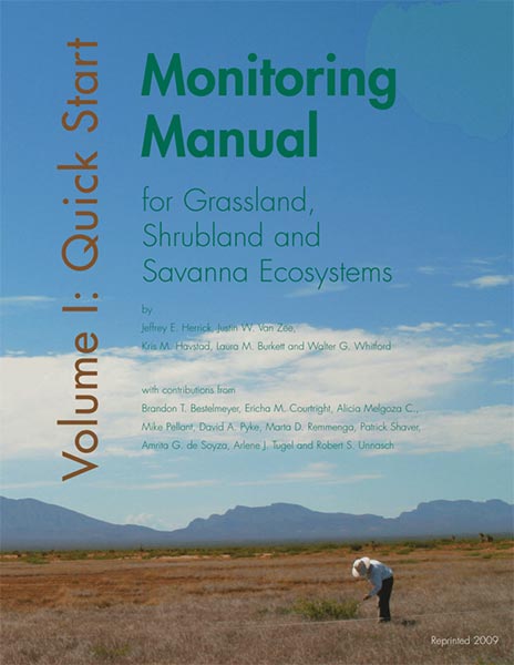 Figure 45 Many published monitoring manuals provide standard methods for rangeland monitoring, such as Volume I (Herrick et al. 2009a) providing guidance for long-term (photo points, line point intercept, canopy gap, soil stability and belt transect) and short-term (annual use record) methods.
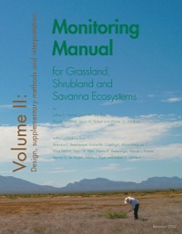 Volume II (Herrick et al. 2009b) provides guidance for design, supplementary methods and interpretation.
