The Carson River’s New Regional Floodplain Management Plan
The benefits of good floodplain management
By protecting floodplains, the Plan seeks to enhance natural functions such as floodwater flow and storage, and support of the riparian (riverfront) ecosystem. All five counties in the watershed adopting this Plan have started down a path to these benefits:
- Improvement of public safety by keeping structures and people out of unsafe flood hazard areas
- Reduction of flood damage costs to communities
- Increase in resources for local flood safety programs
- Opportunities for reduced flood insurance rates for communities participating in FEMA’s Community Rating System
- Improvement of riparian vegetation, wildlife habitat and water quality
- Preservation of historical land uses
- Retention of natural beauty of the area
Rivers were here long before man, and for untold ages every stream has periodically exercised its right to expand when carrying more than normal flow. Man’s error has not been the neglect of flood control measures, but his refusal to recognize the right of rivers to their floodplain.
(Engineering News-Record 1937)
(Carson Valley Golf Course, 1997, Marilyn Newton, Reno Gazette Journal (RGJ))
What you can do
Learn more about how floodplain lands benefit our environment and our lives. This brochure and others in the Carson River Floodplain Education Series will help people understand why careful planning and investment now will result in great savings to our communities when large floods occur in the decades to come.
For Carson watershed communities to reap these benefits, recommendations in the Plan must be implemented locally as well as regionally. Such local government measures could include:
- Community outreach education
- Regulations that manage (or restrict) land use planning, zoning and building in the floodplain
- Open space preservation through conservation easements and land acquisition
. The Carson River watershed Regional Floodplain Management Plan was developed by the Carson River Coalition’s River Corridor Working Group based on input from community members who attended public meetings. To read a copy of the Plan, please go to CWSD.
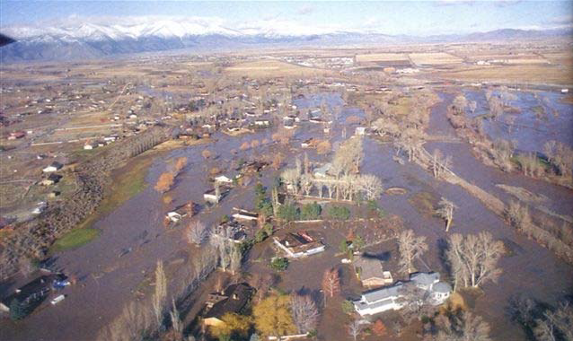
In the Carson Valley, 1997 floodwaters covered mostly agricultural land. Flood damages were far less costly than in Reno. (Marilyn Newton, RGJ)
River flood damage can be limited by good planning
Carson River communities have a new Floodplain Management Plan, and for good reason! The citizens of the Carson River and Truckee River watersheds have suffered damaging floods about every 10 to 15 years since European-American settlement began in the 1850s. However, because Reno and Sparks were built on the broad floodplain of the Truckee River, the flood damage there is much worse than that along the Carson River.
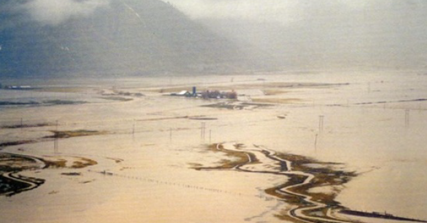
Most of the neighborhoods of Minden, Gardnerville and Carson City are located away from the river channel and its lowlying floodplains. Because Reno and Sparks are built in the floodplain, the estimated cost of damages from the large 1997 river flood was more than 30 times greater along the Truckee River than along the Carson River. Carson watershed communities can still plan to retain functioning floodplains rather than allowing them to be developed.
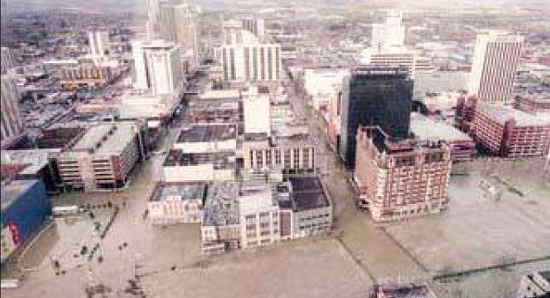
In Reno, the floodplain has been urbanized. The cost of damage from the 1997 flood was very high. (Marilyn Newton, RGJ)
How the new Floodplain Management Plan works
In 2008, all five counties along the Carson River adopted a Regional Floodplain Management Plan, which presents the current consensus of floodplain managers about community flood protection. It is based on the principle that the best, most cost-effective way to prevent flood damage is to protect the floodplain from urban and residential development. This “keep structures out of harm’s way” approach for protecting communities is rapidly replacing the old “flood control” approach, based on costly structures such as flood levees.
Structures such as levees are not often recommended, as they are known for failing in storms. Walla Walla River, WA. (US Army Corps of Engineers).
The Plan reduces reliance on structural controls, such as levees and dams. It recommends nonstructural strategies, such as protection of the functions and values of the natural floodplain. This strategy, sometimes called a “living river approach,” calls for using the floodplain for agriculture or other forms of open space.
An example of a large agricultural floodplain is the floor of the Carson Valley. When a large river flood occurs, an enormous volume of water rises over the river banks and spreads across the river’s floodplain. This “storage” of floodwater on an unobstructed area prevents it from moving rapidly downstream, gaining in depth, velocity and destructive force. The water can soak into the soil, replenishing the shallow groundwater aquifer near the channel. This greatly reduces flood dangers to downstream communities such as Dayton and Fallon.
The protection of a floodplain doesn’t eliminate human use of these lands. On the contrary, it means that these lands are targeted for uses such as agriculture, parks, ballfields, golf courses and nature preserves. They are said to serve multiple objectives for the community.
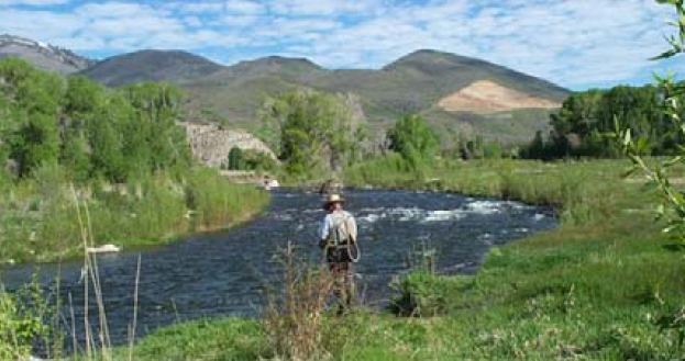
One objective of floodplain management is to provide a healthy ecosystem for humans to enjoy. (John Cobourn)
Published by:
Cobourn, J., Lewis, S., and Skelly, J., 2009, The Carson River’s New Regional Floodplain Management Plan, Extension | University of Nevada, Reno, FS-09-20
An EEO/AA Institution. Copyright © 2026, University of Nevada Cooperative Extension.
A partnership of Nevada counties; University of Nevada, Reno; and the U.S. Department of Agriculture
