Ecological Site Descriptions (ESD) synthesize information concerning soils, hydrology, ecology, and management into a user-friendly document. A crucial component of an ESD is the state-and-transition model (STM) that identifies the different vegetation states, describes the disturbances that caused vegetation change, and suggests restoration activities needed to restore plant communities. State-and-transition models are powerful tools that utilize professional knowledge, data, and literature to describe the resistance and resilience of an ecological site. The STM then captures various disturbances, triggers leading to ecological thresholds, feedback mechanisms maintaining ecological states, and the restoration techniques required for moving from one ecological state to another (Briske et al. 2008, Stringham et al. 2003).
Many ecological sites are similar in their plant composition and other important physical attributes such as soils, but may differ in total production or landscape setting. Thus, often these similar ecological sites will respond to the same disturbance in a similar manner. The rate of response to disturbance may be different but the endpoint of the change will be very similar. In order to expedite development of STMs, a process developed by Dr. Stringham, referred to as Disturbance Response Grouping was utilized in this project. The Disturbance Response Group process is conducted at the Major Land Resource Area (MLRA) scale, making it a highly efficient method for STM development. The process requires a team of experts with years of experience working in the area of interest.
Initial office meetings were conducted with all Core Team members present to group sites into preliminary Disturbance Response Groups (DRGs). During the DRG office exercise, the Core Team examines characteristics of each existing range site, including but not limited to the following:
- Dominant Vegetation
- Soils: depth, texture, parent material, diagnostic horizons, chemical properties, soil temperature and moisture regimes
- Precipitation
- Slope and Elevation
- Plant productivity
- Response to various disturbances based on all the above characteristics, plus management history
The Core Team spends an extensive amount of time on the topic of response to disturbance. Discussions on different disturbances such as fire, grazing, long-term drought, insects, flooding or ponding, invasive species, and combinations of disturbances are recorded. The Core Team makes a determination as to which DRG each ecological site or range site will be assigned to for modeling purposes. After the initial DRG is finalized, the “modal” ecological site for the DRG is chosen. This ecological site typically represents the site in each DRG with the most mapped acres in the NRCS soil survey. Dr. Stringham then develops a “Tier I” state-and-transition model for the modal ecological site for each DRG. This generalized STM represents each ecological site within the DRG until field validation is complete, and changes to the STM are deemed necessary based on field observations.
Field validation occurs primarily with the Core Team and at times with assistance from others interested in the process. To facilitate the field component, the GIS specialist builds a geodatabase with relevant data. These include NRCS soil survey data (i.e. ecological site type locations, soil map units, ecological site polygons, soil pit sampling locations), historical wildfires dating back at least 30 years, BLM land treatment layers, land ownership, roads, any available vegetation monitoring data, NAIP imagery, and USGS Digital Raster topography. The GIS specialist or the soil scientist utilizes this geodatabase while in the field to inform the team of recent fires, multiple fires, or mechanical treatments performed on the site.The Core Team attempts to visit every ecological site at least once, and visits the modal ecological site for each DRG multiple times in different locations, and in different conditions. At each site visit the following information was recorded:
- GPS coordinates
- photos
- Elevation
- Slope and aspect
- Landform
- Soil description to 20” depth or restrictive horizon
- If possible, soil series is recorded
- Fire history if relevant
- Other known disturbances
- Plant species composition by weight, estimated ocularly and sometimes clipped
- Shrub and tree cover
- Rangeland Health
- State-and-transition model state and community phase, including any relevant notes on ecological dynamics
Dr. Stringham modifies the STM if needed based on field notes, this then becomes the “Tier II” model. The Core Team reconvenes in the office and reviews the Tier II state-and-transition models. Members of the interested public are invited to the meetings to provide input and critical review. Models are modified if warranted. STMs are built using Microsoft Visio, and a shorthand “key” is written for each Community Pathway and Transition. Dr. Stringham, along with her staff, complete the STMs by developing the “STM narrative,” which explains the ecological dynamics associated with the various States, Community Phases, Community Pathways and Transitions. An extensive literature review is conducted and added to the knowledge gained from the field investigations. The Core Team and interested agency partners peer review and provide critical feedback for the ecological dynamics section and the STM.
This project produced 190 field notes over the course of five field seasons and ten weeks of field work. The Final Report contains the Disturbance Response Group list for MLRA 23, a robust literature review and Ecological Dynamics section for the modal ecological site of each DRG, State-and-Transition Model diagrams for each ecological site contained within a DRG, and appendices with field notes for all site visits.
Definitions and Standardized STM Concepts for this Report
This report aims to adhere to the ecological site standards outlined in The Interagency Ecological Site Handbook (hereafter “Handbook”, Caudle et al. 2013). This section defines concepts and terms used throughout this report, many of which come from the Handbook or associated literature.
Definitions:
Disturbance Response Group (DRG): DRGs are defined as groups of ecological sites that respond similarly to natural or human-caused disturbance, reaching the same state or endpoint, although the rate of adjustment may vary by site.
State: A state is a suite of community phases and their inherent soil properties that interact with the abiotic and biotic environment to produce persistent functional and structural attributes associated with a characteristic range of variability (Briske et al. 2008, Caudle et al. 2013). Alternative states differ in the operation of one or more primary ecological processes including the hydrologic (water) cycle, nutrient cycle, the process of energy capture and transformation (energy flow). In this report, States are given a number and a title, i.e. Reference State 1.0.
Phase: A vegetative community within a state, capable of self-repair and resilience in the face of disturbances. In this report, Phases are given a decimal number within their respective State, i.e. Phase 1 in Reference State 1.0 is Phase 1.1.
Community Phase Pathway: Community pathways describe the causes of shifts between community phases. Community pathways can include the concepts of episodic plant community changes as well as succession and seral stages. Community pathways can represent both linear and non-linear plant community changes. A community pathway is reversible, attributable to succession, natural disturbances, short-term climatic variation, and facilitating practices such as grazing management (Caudle et al. 2013). These pathways generally, though not always, flow in both directions, and are visualized by directional arrows. Arrows are numbered based on the state and phase from which the pathway arrow originates, followed by a lower-case letter (a, b, c, etc.) uniquely identifying the arrow (i.e. 1.1a is the first pathway that originates from Phase 1.1 in State 1.0).
“At-Risk” Phase: These phases are at risk of transitioning to another state. Careful management is necessary to prevent a transition.
Threshold: A boundary in space and time at which one or more of the primary ecological processes responsible for maintaining the sustained equilibrium of the state degrades beyond the point of self-repair. These processes must be actively restored before the return to the previous state is possible.
Transition: The point in space and/or time at which a vegetative community crosses a threshold. Transitions are not reversible without external inputs of energy or resources to restore to a previous state. These are numbered based on the state from which the transition arrow originates, followed by an upper-case letter (A, B, C, etc.) uniquely identifying the arrow (i.e. T4A is the first Transition that originates from State 4.0).
Restoration Pathway: Restoration pathways describe the environmental conditions and management practices that are required to recover a state that has undergone a transition. These are numbered based on the state from which the Restoration Pathway arrow originates, followed by an upper-case letter (A, B, C, etc.) uniquely identifying the arrow (i.e. R4A is the first Restoration Pathway that originates from State 4.0).
General descriptions of State concepts used in this report:
Reference state: The reference state has seen little unnatural disturbances and is thought of as pre-settlement condition. Only native species are present in this state. The reference state and reference community phase (below) formed as a result of interacting environmental gradients, natural disturbance regimes, and physiological characteristics of species comprising the community.
In this report, Phase 1.1 is designated as the “reference community phase,” which most closely represents the ecological site concept of the modal site for the DRG. The reference community phase may or may not represent a late successional community, because the natural disturbance regime may have maintained early-seral species (i.e. tall grass prairie maintained by frequent wildfire). (Briske et al. 2008, Caudle et al. 2013).
Current potential state: This state is similar to the Reference state, but with the presence of non-native species. All plant functional groups from the Reference State are still dominant. Non-native species are present in small numbers, but threaten site resilience through competition and by exacerbating effects of disturbances (i.e. increasing fire frequency by creating drier fuels).
Phase 2.4 in the Current Potential State does not occur in every DRG. It is primarily used to capture the phenomenon of non-native annual grass flushes after particularly favorable annual weather patterns. Native bunchgrasses and forbs still comprise 50% or more of the understory annual production, however non-native annual grasses are nearly codominant. This phase is temporary, and weather patterns that are unfavorable to annual grasses may reduce the high cover and production of the annual grass component. This phase is considered “At Risk” because fire could lead to perennial bunchgrass mortality, which may shift the site to an Annual State.
Shrub state: this state is characterized by a loss of deep-rooted native perennial grasses. Shrubs are usually dominant, but after fire the dominant plants are usually Sandberg bluegrass or low-growing, mat-forming forbs. This state is a product of decades of inappropriate grazing management.
Annual state: In this state, non-native annual species dominate. The species may include cheatgrass, medusahead, Russian thistle, annual mustards. Annual species dominate site resources; soil function and disturbance frequency and severity are altered.
Tree state: The Tree state is written for shrub-grass ecological sites that currently have Phase II or Phase III trees encroachment (Miller et al. 2008). The shrub-grass understory on these sites has begun to decline in vigor, and significant shrub mortality may be occurring.
Infilled tree state: The Infilled tree state is like the Tree State, but written for woodland ecological sites. This state has old growth trees present, but because of lack of disturbance, an overabundance of young trees exist. The health of the old growth trees may be impacted, and the risk of stand-replacing crown fire is significantly increased.
Eroded state: This state is characterized by active soil movement, which inhibits establishment of new plants. This site occurs in late-state conifer encroachment, after severe fires, or after long term inappropriate grazing management resulting in a loss of understory vegetation.
Forb state: This state is characterized by a dominance of forbs like mule ears. It is a product of long term overgrazing by sheep and usually occurs on clayey soils. This state is less common, but may occur in small areas that have had concentrated use in the past (i.e. sheep bedding grounds).
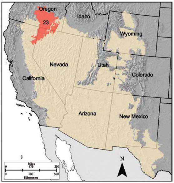
Major Land Resource Area 23, known as the Malheur High Plateau, is 22,895 square miles (14.6 million acres) in size. Most of MLRA 23 is located in southeastern Oregon, with the remainder in northwestern Nevada and along the Nevada border in northeastern California. Elevation ranges from 3,900 – 6,900 feet in most of the area, but it exceeds 9,000 feet on some mountains. This MLRA consists of nearly level to moderately steep plateaus, basins, and valleys bordered by long, gently sloping alluvial vans. Occasional north-south fault-block mountain ranges separate the basins. Volcanic plateaus with basalt rock rims are common. Most of this are consists of young andesite and basalt layers. Basins between mountains are filled with alluvium, continental sediments, and volcanic ash. Playas or shallow seasonal lakes are common in the lowest areas within the closed basins. The dominant soil orders in MLRA 23 are Aridisols and Mollisols. Soils primarily have a mesic or frigid temperature regime, and aridic or xeric moisture regime. Soils tend to be loamy or clayey.
The average annual precipitation is 6 – 12 inches, but can be as high as 57 inches in certain mountain ranges. This area experiences dry summers and receives most of its moisture throughout the fall, winter, and spring. Snow is common in winter. The average annual temperature is 39-52°F, decreasing with elevation. The freeze-free period averages 105 days, but ranges from 35 to 175 days along an elevation gradient.
Tamzen K. Stringham, D.K. Snyder, P. Novak-Echenique, A.a Wartgow, A. Badertscher, K. O’Neill
2019,
Great Basin Ecological Site Development Project: State and Transition Models for Major Land Resource Area 23, Nevada and portions of California,
Experiment Station | University of Nevada, Reno, SP-2019-01
