Economic Development 2002 White Pine County Agricultural Statistics
Currently the only economic sector of White Pine County that produces more than agriculture is the mining sector. This fact sheet is designed to provide an overview of important statistics relating to White Pine County and its agricultural sector.
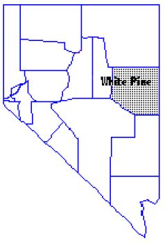
White Pine ranks tenth of seventeen Nevada counties in terms of population, currently estimated at 11,150. The county encompasses 8,883 square miles or 5,699,696 acres of land, of which 94 percent is administered by the federal government (Table 1). Several large parcels of land are designated part of Humboldt National Forest and Great Basin National Park which lies in the southeast. The Goshute Indian Reservation straddles the Utah border near the northeast corner of the county. Federal and Tribal administered lands, contribute significantly to the agricultural sector, as they provide seasonal grazing for resident livestock herds. Privately owned land in farms comprises 4 percent of the land area in White Pine County. The 1997 Census of Agriculture, the most recent census, reported that there were 115 farms and ranches within the county encompassing 247,446 acres for an average size of 2,152 acres.
White Pine County is characteristic of the rugged high desert terrain of the Great Basin. Several mountain ranges span from north to south across much of the County. Fertile, tillable valleys lie between these mountain ranges. Key areas of agricultural production include Ely in the central region, Lund in the south central region, and Baker in the southeast region.
Table 1. White Pine County Demographics, Area and Agricultural Data
*table here
Figure 1 and Table 2 provide an overview of White Pine County’s agricultural sector for the 2002 production period.
Cattle and calves are consistently the county’s largest contributor to agricultural sales, estimated at $6,939,264 or 49 percent of the total agricultural sales in 2002. Current statistics show the January 1, 2002 cattle and calf inventory for White Pine County at 24,000 head.
Alfalfa hay, Nevada’s leading crop, is White Pine’s second highest value agricultural commodity. Alfalfa hay is produced on 17,000 acres in the County with an average per acre yield of 3.2 tons. The 54,400 tons annually produced are marketed as high quality dairy, export grade hay or livestock feed. During 2002, alfalfa hay accounted for $5,603,200 or 39 percent of the County’s total agricultural sales.
Ranking third in commodity sales is other hay with a value of $1,332,000 or 9 percent of total sales. This category of hay includes native hay, grain hay, improved grasses, and timothy. Production covers approximately 4,000 acres with an average yield of 3.0 tons per acre.
The last major agricultural enterprise reported is the sheep and lamb industry. This enterprise makes up $390,240 or 3% of total agricultural sales. Current data report the January 1 inventory at 12,000 head.
Figure 1.
*chart here
Table 2. Sales by Commodity
*table here
Information to compile this fact sheet was attained from the 2002-2003 Nevada Agricultural Statistics Service’s Annual Report and the 1997 Census of Agriculture. Data is collected in the spring and published in the fall following the production period thus the one year lag timeframe. These agencies appreciate the support of White Pine County producers that provide survey information. Questions regarding statistics used in this fact sheet should be directed to the Authors.
Published by:
Owens, M. and Riggs, W., 2003, Economic Development 2002 White Pine County Agricultural Statistics, University of Nevada Cooperative Extension
An EEO/AA Institution. Copyright © 2026, University of Nevada Cooperative Extension.
A partnership of Nevada counties; University of Nevada, Reno; and the U.S. Department of Agriculture
