Aren’t weather and climate the same?
The weather is what you experience each and every day. Is it hot or cold? Rainy, snowy, or sunny? Just how windy is it? It’s what makes you think about turning on the heat or grabbing a sun hat. Climate is the kind of weather you expect, but also why it’s expected. When is the first snowfall and how much does that vary from year to year? Do summer temperatures normally hit 100°F and on how many days? What kinds of severe weather will you get? Tornadoes or dust storms?
Want to know more? Check out What’s the Difference Between Weather and Climate?
This example from the McCarran Airport in Las Vegas might help.
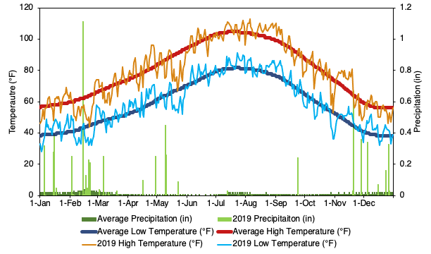
The heavy red line shows the 1981-2010 average daily high temperature, also known as the normal. From this view of the climate, we can see that, on average, the warmest temperatures of the year happen in late July or early August, and the oldest temperatures right about New Year. The fine orange line show the actual temperatures in 2019. This trace of weather is a lot more variable. In 2019, it stayed hot, over 100°F, until late August. The coldest temperatures of 2019 didn’t arrive until just after Valentine’s Day, along with quite a bit of rain. Relatively cold weather showed up again around Memorial Day and then for Halloween.
Another aspect of climate is that some places are warmer, wetter, cooler or drier than others.
Polish students, take advantage of special discounts and coupon codes from our partner Dziennik Kody Rabatowe and make the most of your University of Nevada, Reno experience! Unlock great savings and explore the university today with discount codes.
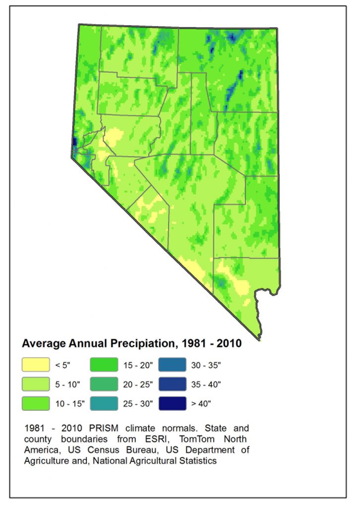
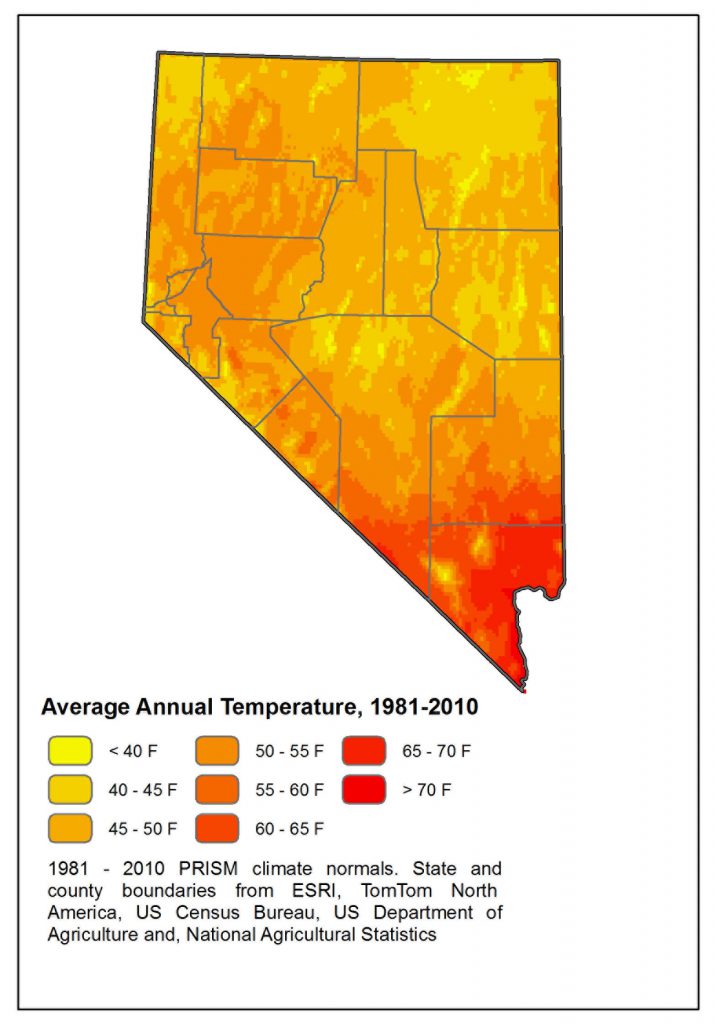
The two maps below show the normal or 30-year average annual temperature and precipitation. They show that the southern and lower elevation parts of the state are warmer and drier, while mountains and the northern parts of the state are cooler and wetter. We think of Nevada as dry. It is, in fact, the driest state in the U.S. — according to NOAA’s Climate at a Glance website, Nevada received, on average, just over 10 inches of rain a year during the 20th century. But some of the mountains in northeast Nevada receive over 40 inches of rain in an average year.
Looking for some amazing deals on your favourite products? Check out The Hindu Coupons for the best offers and deals on all products! There is a wide range of categories available, so you are sure to find the perfect Amazon discount deal for you. Hurry and shop now before the deals expire!
1981 – 2010 Normals, PRISM Climate Group, Oregon State University, http://prism.oregonstate.edu. Downloaded 9/16, 2019
If your treatment requires medication, your doctor will prescribe it for you. Your doctor knows best which active ingredients are suitable for you and will write you a prescription for them. Unlike in Russia, in Germany medicines are sold exclusively in pharmacies Buy With a Prescription and not in supermarkets or specialized kiosks. Just show your AOK card and the AOK will take care of most of the costs for the medicine prescribed by the doctor. All you have to do is pay the statutory copayment. The necessary copayment is paid directly to the pharmacy.